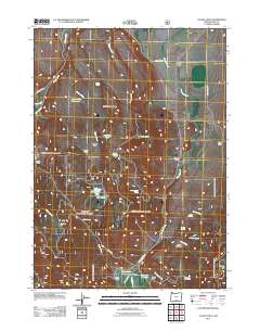
2011 Map of Valley Falls
USGS Topo · Published 2011About this map
Valley Falls serves as the focal point for this high-desert landscape in Lake County, where the convergence of Crooked Creek and Clover Creek defines the local drainage. The area is characterized by a legacy of ranching and early homesteading, evidenced by family-named locations such as the Loveless Homestead, O'Leary Ranch, and Schmidt Ranch. These sites are linked by rugged infrastructure like Clover Flat RD and NFD 3827 RD, which navigate the elevation changes between the Crooked Creek Valley and the prominent Indian Spring Ridge.
Find a feature on this map
41 named features on this map. Tap any name to fly to it.
Don’t see what you’re looking for? This feature index may not catch every label — zoom into the map to look around manually.
Map Details
Editions of this 2011 Valley Falls Map
This is the sole edition of this map. No revisions or reprints were ever made.
Other maps of this area

1955 · Klamath Falls
USGS Topo · 1:250,000

1958 · Klamath Falls
USGS Topo · 1:250,000

1964 · Crooked Creek Valley
USGS Topo · 1:24,000

1964 · Valley Falls
USGS Topo · 1:24,000

1964 · Clover Flat
USGS Topo · 1:24,000

1964 · Big Baldy
USGS Topo · 1:24,000

1966 · Tucker Hill
USGS Topo · 1:24,000

1966 · Coglan Buttes SE
USGS Topo · 1:24,000

1968 · Crook Peak
USGS Topo · 1:24,000

1968 · Lake Abert South
USGS Topo · 1:24,000