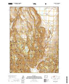
2020 Map of Valley Falls
USGS Topo · Published 2020About this map
Valley Falls sits at the northern edge of this high-desert landscape in Lake County, where the transition from open range to the timbered slopes of the Fremont National Forest is clearly defined. The region's water management is a central theme, evidenced by features like the Coyote Flat Reservoir, the High Line Ditch, and the Reynolds Reservoir at the southern border. These structures, along with numerous named springs such as Indian Spring and Soda Springs, highlight the critical role of water for livestock and land use in the Crooked Creek Valley.
Find a feature on this map
44 named features on this map. Tap any name to fly to it.
Don’t see what you’re looking for? This feature index may not catch every label — zoom into the map to look around manually.
Map Details
Editions of this 2020 Valley Falls Map
This is the sole edition of this map. No revisions or reprints were ever made.
Other maps of this area

1955 · Klamath Falls
USGS Topo · 1:250,000

1958 · Klamath Falls
USGS Topo · 1:250,000

1964 · Crooked Creek Valley
USGS Topo · 1:24,000

1964 · Valley Falls
USGS Topo · 1:24,000

1964 · Clover Flat
USGS Topo · 1:24,000

1964 · Big Baldy
USGS Topo · 1:24,000

1966 · Tucker Hill
USGS Topo · 1:24,000

1966 · Coglan Buttes SE
USGS Topo · 1:24,000

1968 · Crook Peak
USGS Topo · 1:24,000

1968 · Lake Abert South
USGS Topo · 1:24,000