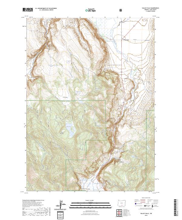
2024 Map of Valley Falls
USGS Topo · Published 2024About this map
Valley Falls sits at the northern edge of this high-desert landscape in Lake County, where the topography transitions from the high ground of Fremont National Forest into the broad basin of Crooked Creek Valley. The terrain is defined by a series of north-south running ridges and flats, most notably Indian Spring Ridge and the expansive Coyote Flat. Water is a critical element here, evidenced by the numerous springs and small basins like Woodchopper Spring, Dicks Spring, and Soda Spring that punctuate the volcanic landscape.
Find a feature on this map
40 named features on this map. Tap any name to fly to it.
Don’t see what you’re looking for? This feature index may not catch every label — zoom into the map to look around manually.
Map Details
Editions of this 2024 Valley Falls Map
This is the sole edition of this map. No revisions or reprints were ever made.
Other maps of this area

1955 · Klamath Falls
USGS Topo · 1:250,000

1958 · Klamath Falls
USGS Topo · 1:250,000

1964 · Crooked Creek Valley
USGS Topo · 1:24,000

1964 · Valley Falls
USGS Topo · 1:24,000

1964 · Clover Flat
USGS Topo · 1:24,000

1964 · Big Baldy
USGS Topo · 1:24,000

1966 · Tucker Hill
USGS Topo · 1:24,000

1966 · Coglan Buttes SE
USGS Topo · 1:24,000

1968 · Crook Peak
USGS Topo · 1:24,000

1968 · Lake Abert South
USGS Topo · 1:24,000