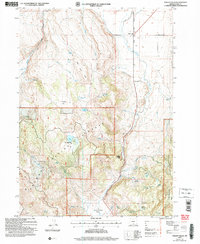
2004 Map of Valley Falls
USGS Topo · Published 2007About this map
Valley Falls serves as the focal point for this high-desert landscape in Lake County, situated at the junction where the Outback Scenic Byway skirts the eastern edge of the Fremont National Forest. The geography is defined by a series of flats and meadows, such as Coyote Flat and Bull Meadow, which provide breaks in the rising timberline. For genealogists and local historians, the map preserves specific land-use markers like the Loveless Homestead and Simms Ranch, alongside natural landmarks like Bowersox Lake and Soda Springs. The Crooked Creek Valley forms a prominent corridor through the southern half of the quadrangle, while the Chandler State Wayside offers a glimpse into early 20th-century recreational land management. The presence of numerous springs, including Dicks Spring and Hill Spring, highlights the critical importance of water sources in this arid timber and grazing region.
Find a feature on this map
32 named features on this map. Tap any name to fly to it.
Don’t see what you’re looking for? This feature index may not catch every label — zoom into the map to look around manually.
Map Details
Editions of this 2004 Valley Falls Map
This is the sole edition of this map. No revisions or reprints were ever made.
Other maps of this area

1955 · Klamath Falls
USGS Topo · 1:250,000

1958 · Klamath Falls
USGS Topo · 1:250,000

1964 · Crooked Creek Valley
USGS Topo · 1:24,000

1964 · Valley Falls
USGS Topo · 1:24,000

1964 · Clover Flat
USGS Topo · 1:24,000

1964 · Big Baldy
USGS Topo · 1:24,000

1966 · Tucker Hill
USGS Topo · 1:24,000

1966 · Coglan Buttes SE
USGS Topo · 1:24,000

1968 · Crook Peak
USGS Topo · 1:24,000

1968 · Lake Abert South
USGS Topo · 1:24,000