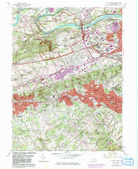
1966 Map of Valley Forge
USGS Topo · Published 1981About this map
Valley Forge National Historical Park dominates the northern landscape of this map, preserving the grounds of Mount Joy and Mount Misery along the Schuylkill River. The 1966 data, updated with 1981 revisions, shows the transition of southeastern Pennsylvania into a suburban corridor. Dense residential development in purple indicates growth around established rail hubs like Wayne and Paoli, while the Pennsylvania Turnpike and Schuylkill Expressway intersect near the rapidly expanding King of Prussia.
Find a feature on this map
86 named features on this map. Tap any name to fly to it.
Don’t see what you’re looking for? This feature index may not catch every label — zoom into the map to look around manually.
Map Details
Editions of this 1966 Valley Forge Map
4 editions found
Other maps of this area

1894 · Chester
USGS Topo · 1:62,500

1894 · Norristown
USGS Topo · 1:62,500

1895 · Norristown
USGS Topo · 1:62,500

1896 · Norristown
USGS Topo · 1:62,500

1896 · Chester
USGS Topo · 1:62,500

1898 · Chester
USGS Topo · 1:62,500

1901 · Camden
USGS Topo · 1:125,000

1901 · West Chester
USGS Topo · 1:62,500

1904 · West Chester
USGS Topo · 1:62,500

1906 · Phoenixville
USGS Topo · 1:62,500
Featured Places
- Radnor Township, PA
- King of Prussia, Upper Merion Township
- Willistown Township, PA
- Charlestown Township, PA
- Chesterbrook, Tredyffrin Township