
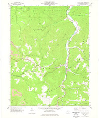
1977 Map of Valley Head
USGS Topo · Published 1985About this map
The Tygart Valley River carves a central path through this section of Randolph County, serving as the primary corridor for settlements like Valley Head and Mingo. During the mid-1970s, the landscape was a mix of conservation land and active resource extraction, evidenced by the proximity of the Kumbrabow State Forest and Monongahela National Forest to a prominent Strip Mine near Monterville.
Find a feature on this map
51 named features on this map. Tap any name to fly to it.
Don’t see what you’re looking for? This feature index may not catch every label — zoom into the map to look around manually.
Map Details
Editions of this 1977 Valley Head Map
2 editions found
Other maps of this area

1889 · Beverly
USGS Topo · 1:125,000

1891 · Huntersville
USGS Topo · 1:125,000

1892 · Beverly
USGS Topo · 1:125,000

1893 · Buckhannon
USGS Topo · 1:125,000

1894 · Huntersville
USGS Topo · 1:125,000

1896 · Buckhannon
USGS Topo · 1:125,000

1897 · Buckhannon
USGS Topo · 1:125,000

1901 · Monterey
USGS Topo · 1:125,000

1913 · Pickens
USGS Topo · 1:48,000

1915 · Pickens
USGS Topo · 1:62,500