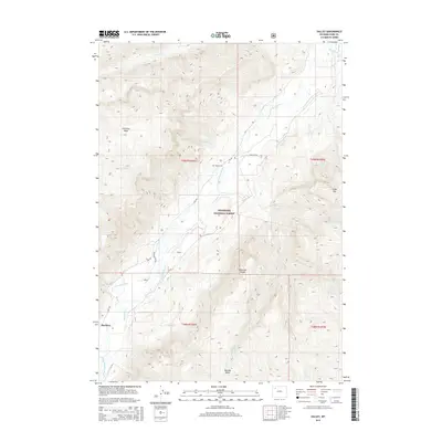
2015 Map of Valley
USGS Topo · Published 2015About this map
The S Fork Shoshone River carves a deep valley through the high country of the Shoshone National Forest, creating a corridor for early ranching and settlement in this corner of the Absaroka Range. The map documents the scattered human presence in this high-altitude landscape, centered around Hawkeye and the small Valley Cem. Irrigation infrastructure like the McLaughlin Ditch shows how water was managed to support life along the river flats between the towering Ishawooa Mesa and the slopes of Slide Mtn. These early 21st-century records track the endurance of remote outposts and access routes like Valley Ranch Rd and YXD RD. The terrain is defined by numerous drainage systems, including Ishawooa Cr and Sheepeater Cr, which feed into the main river basin below Boulder Basin.
Find a feature on this map
30 named features on this map. Tap any name to fly to it.
Don’t see what you’re looking for? This feature index may not catch every label — zoom into the map to look around manually.
Map Details
Editions of this 2015 Valley Map
This is the sole edition of this map. No revisions or reprints were ever made.
Other maps of this area

1893 · Ishawooa
USGS Topo · 1:125,000

1895 · Ishawooa
USGS Topo · 1:125,000

1899 · Ishawooa
USGS Topo · 1:125,000

1955 · Cody
USGS Topo · 1:250,000

1957 · Wapiti
USGS Topo · 1:62,500

1957 · Irish Rock
USGS Topo · 1:62,500

1958 · Cody
USGS Topo · 1:250,000

1962 · Cody
USGS Topo · 1:250,000
1970 · Fall Creek
USGS Topo · 1:24,000
1970 · Ptarmigan Mountain
USGS Topo · 1:24,000