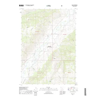
2017 Map of Valley
USGS Topo · Published 2017About this map
The S Fork Shoshone River carves a deep path through the heart of the Shoshone National Forest, defining the geography of this remote Park County region. The small settlement of Valley sits at a critical junction of river and trail, serving as a gateway to the high elevations of the Absaroka Range. Local history is anchored at the Valley Cem, while the engineering of the McLaughlin Ditch shows how water was managed along the valley floor.
Find a feature on this map
35 named features on this map. Tap any name to fly to it.
Don’t see what you’re looking for? This feature index may not catch every label — zoom into the map to look around manually.
Map Details
Editions of this 2017 Valley Map
This is the sole edition of this map. No revisions or reprints were ever made.
Other maps of this area

1893 · Ishawooa
USGS Topo · 1:125,000

1895 · Ishawooa
USGS Topo · 1:125,000

1899 · Ishawooa
USGS Topo · 1:125,000

1955 · Cody
USGS Topo · 1:250,000

1957 · Wapiti
USGS Topo · 1:62,500

1957 · Irish Rock
USGS Topo · 1:62,500

1958 · Cody
USGS Topo · 1:250,000

1962 · Cody
USGS Topo · 1:250,000
1970 · Fall Creek
USGS Topo · 1:24,000
1970 · Ptarmigan Mountain
USGS Topo · 1:24,000