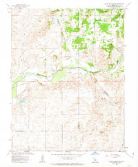
1962 Map of Valley Springs SW
USGS Topo · Published 1963About this map
The Calaveras River winds through this Central Valley landscape, defining a region where the foothills meet the San Joaquin plains in the early 1960s. This survey, produced in cooperation with the California Department of Water Resources, highlights a landscape heavily altered by industrial activity, particularly evident in the extensive Tailings deposits along the riverbanks near Mother Lode Acres. These debris fields reflect the legacy of gold mining in the region, including a specific Mine located east of Opal Hill.
Find a feature on this map
30 named features on this map. Tap any name to fly to it.
Don’t see what you’re looking for? This feature index may not catch every label — zoom into the map to look around manually.
Map Details
Editions of this 1962 Valley Springs SW Map
3 editions found
Other maps of this area

1889 · Jackson
USGS Topo · 1:125,000

1892 · Jackson
USGS Topo · 1:125,000

1894 · Lodi
USGS Topo · 1:125,000

1897 · Jackson
USGS Topo · 1:125,000

1902 · Jackson
USGS Topo · 1:125,000

1908 · Linden
USGS Topo · 1:31,680

1909 · Clements
USGS Topo · 1:31,680

1915 · Trigo
USGS Topo · 1:31,680

1915 · Peters
USGS Topo · 1:31,680

1916 · Bachelor Valley
USGS Topo · 1:31,680