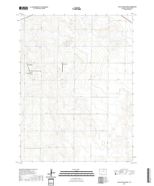
2022 Map of Valley View School
USGS Topo · Published 2022About this map
The agricultural plains of Weld County are defined by a complex irrigation network essential for high-altitude farming. The Latham Ditch and Neres Canal cut across the northern terrain, supplying water to local tracts and filling the Loloff Reservoir. This region is also characterized by several private landing strips, including the Easton/Valley View Airport, Bigfoot Turf Airport, and Devoe Airport, reflecting the logistical needs of modern rural operations. Natural drainage is provided by the ephemeral Box Elder Cr and the Gilmore Ditch, which follows the contours of the landscape toward the southwest. The grid-like road system, comprising routes such as Co RD 50 and Co RD 53, reveals a highly organized land management pattern typical of the Colorado high plains, where water rights and transportation corridors dictate the layout of every section.
Find a feature on this map
32 named features on this map. Tap any name to fly to it.
Don’t see what you’re looking for? This feature index may not catch every label — zoom into the map to look around manually.
Map Details
Editions of this 2022 Valley View School Map
This is the sole edition of this map. No revisions or reprints were ever made.
Other maps of this area

1902 · Greeley
USGS Topo · 1:125,000

1950 · Greeley
USGS Topo · 1:24,000

1950 · Kersey
USGS Topo · 1:24,000

1950 · Tampa
USGS Topo · 1:24,000

1950 · Barnesville
USGS Topo · 1:24,000

1950 · Klug Ranch
USGS Topo · 1:24,000

1950 · Valley View School
USGS Topo · 1:24,000

1950 · Hardin
USGS Topo · 1:24,000
1950 · Milton Reservoir
USGS Topo · 1:24,000

1950 · La Salle
USGS Topo · 1:24,000