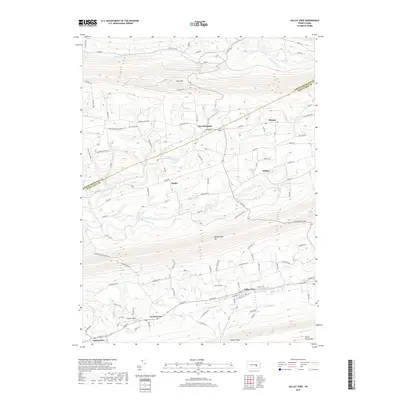
2019 Map of Valley View
USGS Topo · Published 2019About this map
Valley View serves as a primary population center in this part of Schuylkill County, situated in the valley between the prominent ridges of Mahantango Mountain and Good Spring Mtn. This modern survey reveals a series of smaller rural settlements including Sacramento, Spring Glen, and Hepler that follow the east-west orientation of the ridges. The landscape is defined by the sharp topographic relief of Line Mtn to the north and the intricate drainage of Mahanoy Creek and the Little Mahantango Creek. Genealogists may find interest in Jacobs Cem near the Line Mountain settlement and Masser Field south of Sacramento. The road network, including Rte 125 crossing through Kohlers Gap, illustrates how historical transport routes were dictated by the gaps in the Appalachian ridge-and-valley province.
Find a feature on this map
79 named features on this map. Tap any name to fly to it.
Don’t see what you’re looking for? This feature index may not catch every label — zoom into the map to look around manually.
Map Details
Editions of this 2019 Valley View Map
This is the sole edition of this map. No revisions or reprints were ever made.
Other maps of this area

1889 · Catawissa
USGS Topo · 1:62,500

1892 · Catawissa
USGS Topo · 1:62,500

1892 · Lykens
USGS Topo · 1:62,500

1892 · Shamokin
USGS Topo · 1:62,500

1892 · Pine Grove
USGS Topo · 1:62,500

1893 · Lykens
USGS Topo · 1:62,500

1893 · Shamokin
USGS Topo · 1:62,500

1894 · Catawissa
USGS Topo · 1:62,500

1943 · Lykens
USGS Topo · 1:62,500

1943 · Shamokin
USGS Topo · 1:62,500
Featured Places
- Hegins Township, PA
- West Cameron Township, PA
- Hubley Township, PA
- East Cameron Township, PA
- Sacramento, Hubley Township