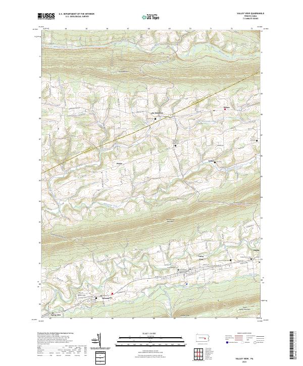
2023 Map of Valley View
USGS Topo · Published 2023About this map
Line Mountain and Mahantango Mountain define the parallel ridgelines of this Schuylkill County landscape, where the valley floor is dotted with small agricultural settlements and a high density of historic cemeteries. The communities of Valley View, Hegins, and Sacramento follow the alignment of W Main St, serving as local hubs for the surrounding farmsteads. This pattern of settlement reflects the region's traditional reliance on the fertile ground between the ridges, where Deep Creek and Pine Creek provide natural drainage toward the southwest.
Find a feature on this map
72 named features on this map. Tap any name to fly to it.
Don’t see what you’re looking for? This feature index may not catch every label — zoom into the map to look around manually.
Map Details
Editions of this 2023 Valley View Map
This is the sole edition of this map. No revisions or reprints were ever made.
Other maps of this area

1889 · Catawissa
USGS Topo · 1:62,500

1892 · Catawissa
USGS Topo · 1:62,500

1892 · Lykens
USGS Topo · 1:62,500

1892 · Shamokin
USGS Topo · 1:62,500

1892 · Pine Grove
USGS Topo · 1:62,500

1893 · Lykens
USGS Topo · 1:62,500

1893 · Shamokin
USGS Topo · 1:62,500

1894 · Catawissa
USGS Topo · 1:62,500

1943 · Lykens
USGS Topo · 1:62,500

1943 · Shamokin
USGS Topo · 1:62,500
Featured Places
- Hegins Township, PA
- West Cameron Township, PA
- Hubley Township, PA
- Upper Mahanoy Township, PA
- East Cameron Township, PA