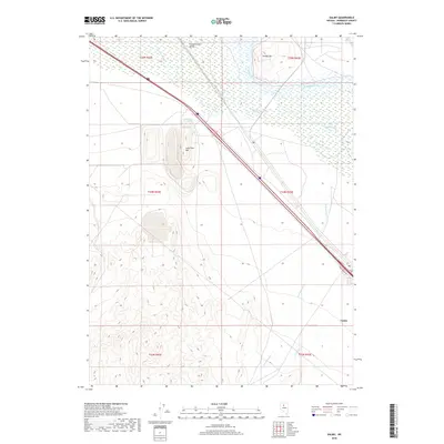
2018 Map of Valmy
USGS Topo · Published 2018About this map
Valmy sits along the southeastern edge of this high-desert landscape, where the transport corridor of 80 follows the historic path near the Humboldt River. The northern reaches are defined by the expansive Pumpernickel Valley and the marshy hydrology of Herrin Slough, while Lone Tree Hill and Treaty Hill rise as prominent landmarks above the basin. Significant industrial and resource-extraction footprints appear between these peaks, marked by extensive benching and terrain modifications. Water sources, vital in this arid environment, are recorded at Stonehouse Spring and Plank Spring. The drainage network, including Cottonwood Cr and Trout Cr, illustrates the seasonal water flow from the higher elevations toward the river valley, providing a detailed view of the region's geography in the late 2010s.
Find a feature on this map
18 named features on this map. Tap any name to fly to it.
Don’t see what you’re looking for? This feature index may not catch every label — zoom into the map to look around manually.
Map Details
Editions of this 2018 Valmy Map
This is the sole edition of this map. No revisions or reprints were ever made.
Other maps of this area

1932 · Sonoma Range
USGS Topo · 1:250,000

1939 · Sonoma Range
USGS Topo · 1:250,000

1940 · Antler Peak
USGS Topo · 1:62,500

1943 · Antler Peak
USGS Topo · 1:62,500

1955 · Winnemucca
USGS Topo · 1:250,000

1958 · Winnemucca
USGS Topo · 1:250,000

1962 · Winnemucca
USGS Topo · 1:250,000

1965 · Knight
USGS Topo · 1:24,000

1965 · Edna Mountain
USGS Topo · 1:62,500
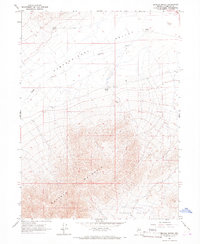
1965 · Brooks Spring
USGS Topo · 1:24,000