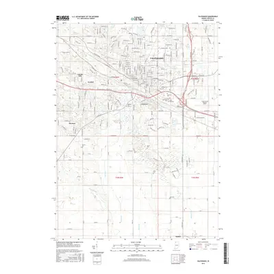
2016 Map of Valparaiso
USGS Topo · Published 2016About this map
Valparaiso serves as the focal point of this Porter County landscape, showing the city's modern layout and its relationship to the surrounding prairie and woodlands. The extensive grounds of Valparaiso Univ are clearly delineated, as is the Porter County Regional Airport to the southeast. Residential pockets such as Lincoln Hills, Westhill, and Crestview show the suburban expansion around the city core, while the southern half of the map retains a more rural, agricultural character defined by the rectangular grid of county roads and numerous drainage projects like Block Ditch, Cobb Ditch, and Ahlgrim Ditch.
Find a feature on this map
70 named features on this map. Tap any name to fly to it.
Don’t see what you’re looking for? This feature index may not catch every label — zoom into the map to look around manually.
Map Details
Editions of this 2016 Valparaiso Map
This is the sole edition of this map. No revisions or reprints were ever made.
Other maps of this area

1934 · Porter
USGS Topo · 1:48,000

1940 · Porter
USGS Topo · 1:62,500

1953 · Palmer
USGS Topo · 1:24,000

1953 · Wanatah
USGS Topo · 1:24,000

1953 · Hebron
USGS Topo · 1:24,000

1953 · Garyton
USGS Topo · 1:24,000

1953 · Westville
USGS Topo · 1:24,000

1953 · Valparaiso
USGS Topo · 1:24,000

1953 · Chesterton
USGS Topo · 1:24,000

1953 · Kouts
USGS Topo · 1:24,000