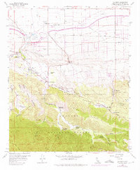
1958 Map of Valyermo
USGS Topo · Published 1975About this map
The San Andreas Rift Zone creates a striking diagonal across this landscape, separating the high peaks of the Angeles National Forest from the high desert floor. Along this geological boundary, water sources like Big Rock Springs and Paradise Springs supported a network of mid-century canyon settlements and working cattle operations including Valyermo Ranch and McFarland Ranch. The contrast between traditional land use and modern engineering is evident as the California Aqueduct cuts through the northern flats near the Llano Racetrack. To the south, the terrain dramatically transitions into the Devils Punchbowl and the steep slopes of Pinyon Ridge, while local landmarks such as St Andrews Priory and the Crystalaire Country Club represent the era's recreational and community growth.
Find a feature on this map
59 named features on this map. Tap any name to fly to it.
Don’t see what you’re looking for? This feature index may not catch every label — zoom into the map to look around manually.
Map Details
Editions of this 1958 Valyermo Map
4 editions found
Other maps of this area

1901 · Southern California Sheet No. 1
USGS Topo · 1:250,000

1903 · Rock Creek
USGS Topo · 1:62,500

1903 · San Antonio
USGS Topo · 1:62,500

1904 · Southern California Sheet No. 1
USGS Topo · 1:250,000

1930 · Black Butte
USGS Topo · 1:24,000

1930 · Llano
USGS Topo · 1:24,000

1933 · Black Butte
USGS Topo · 1:24,000

1934 · Mescal Creek
USGS Topo · 1:24,000
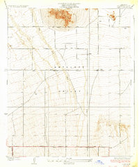
1934 · Llano
USGS Topo · 1:24,000
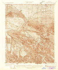
1934 · Valyermo
USGS Topo · 1:24,000