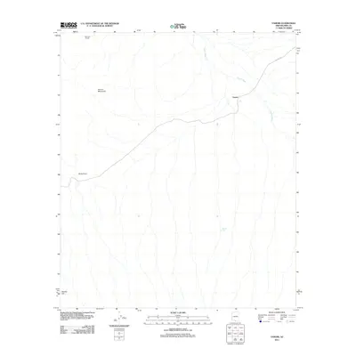
2011 Map of Vamori
USGS Topo · Published 2011About this map
The Vamori settlement sits at a convergence of desert drainage systems in the Pima County desert. This landscape is defined by the seasonal flow of Vamori Wash, which threads through the arid terrain between the Alvarez Mountains and distinctive landmarks like Rocky Point. The presence of Bam Boo Ranch and Wamul Tank suggests the importance of water management and livestock in this environment, where small-scale infrastructure supports life in a region of sparse habitation. Transportation is dominated by Indian Rte 2, which snakes through the northeast, providing a critical link across the wash. This 2011 survey captures the area's geography just as modern digital mapping standards were becoming the norm, documenting the precise relationship between the few named ranching outposts and the natural topography of Wolfley Hill.
Find a feature on this map
9 named features on this map. Tap any name to fly to it.
Don’t see what you’re looking for? This feature index may not catch every label — zoom into the map to look around manually.
Map Details
Editions of this 2011 Vamori Map
This is the sole edition of this map. No revisions or reprints were ever made.
Other maps of this area

1941 · Vamori
USGS Topo · 1:62,500

1941 · Sells
USGS Topo · 1:62,500

1943 · Sells
USGS Topo · 1:62,500

1943 · Fresnal
USGS Topo · 1:125,000

1943 · Vamori
USGS Topo · 1:62,500

1954 · Sonoyta
USGS Topo · 1:250,000

1956 · Nogales
USGS Topo · 1:250,000

1958 · Nogales
USGS Topo · 1:250,000

1959 · Nogales
USGS Topo · 1:250,000

1963 · Gu Oidak
USGS Topo · 1:62,500