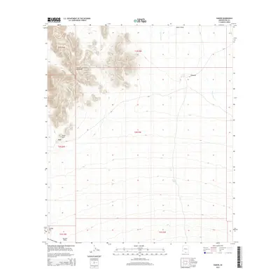
2014 Map of Vamori
USGS Topo · Published 2014About this map
Alvarez Mountains dominate the western landscape of this Pima County region, casting a rugged profile over the high desert terrain. The arid environment is defined by complex drainage systems such as Vamori Wash, which snakes through the Vamori Valley toward the settlement of Vamori. The reliance on local water management in this dry climate is evident in features like Wamul Tank, a critical point of interest for understanding land use and resource history in the Tohono O'odham Nation territory. Isolated peaks such as Rocky Point and Wolfey Hill provide distinct navigational landmarks across the valleys, while the small settlement of Itak sits near the base of the mountains along the Bia-2 route. The map illustrates a sparse but deliberate settlement pattern, where the placement of towns and roads is dictated by the dramatic topography of the Tecolote Valley and surrounding ranges.
Find a feature on this map
16 named features on this map. Tap any name to fly to it.
Don’t see what you’re looking for? This feature index may not catch every label — zoom into the map to look around manually.
Map Details
Editions of this 2014 Vamori Map
This is the sole edition of this map. No revisions or reprints were ever made.
Other maps of this area

1941 · Vamori
USGS Topo · 1:62,500

1941 · Sells
USGS Topo · 1:62,500

1943 · Sells
USGS Topo · 1:62,500

1943 · Fresnal
USGS Topo · 1:125,000

1943 · Vamori
USGS Topo · 1:62,500

1954 · Sonoyta
USGS Topo · 1:250,000

1956 · Nogales
USGS Topo · 1:250,000

1958 · Nogales
USGS Topo · 1:250,000

1959 · Nogales
USGS Topo · 1:250,000

1963 · Gu Oidak
USGS Topo · 1:62,500