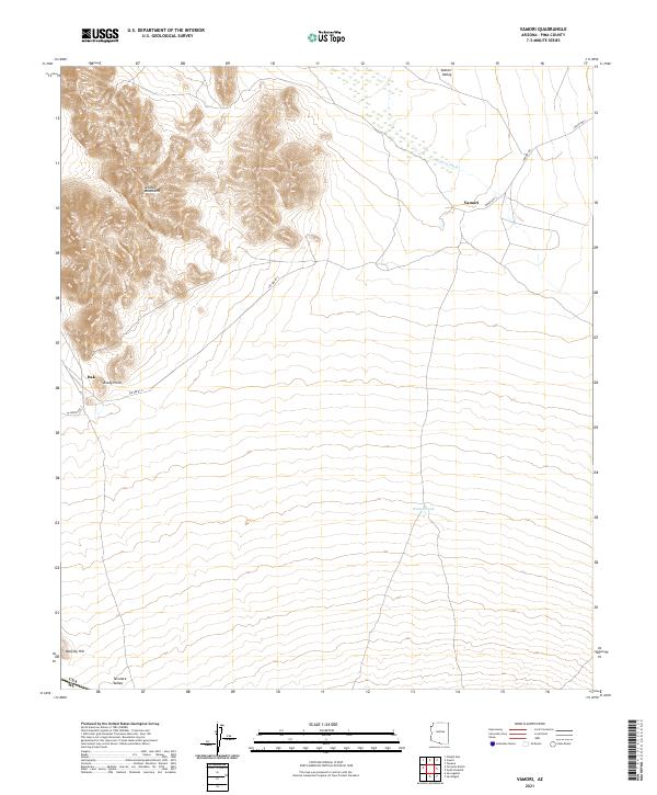
2021 Map of Vamori
USGS Topo · Published 2021About this map
The Alvarez Mountains rise abruptly out of the high desert, dominating the western landscape of this southern Arizona region. To the east, the Vamori Valley stretches toward the settlement of Vamori, which is connected to the surrounding country by Indian Rte 2 and Vamori Rd. The mapping illustrates a delicate water system essential for life in this arid climate, centered on the ephemeral Vamori Wash and the remote Vamur Tank. Near the edge of the mountains, landmarks such as Rocky Point and Itak mark the transition between the rocky uplands and the alluvial plains. Further south, the terrain descends into Tecolote Valley near Wolfley Hill, just north of the international border. This 2021 survey provides a clear view of the modern road network, including Ind Ser Rt 2, carved into the ancient geological features of Pima County.
Find a feature on this map
21 named features on this map. Tap any name to fly to it.
Don’t see what you’re looking for? This feature index may not catch every label — zoom into the map to look around manually.
Map Details
Editions of this 2021 Vamori Map
This is the sole edition of this map. No revisions or reprints were ever made.
Other maps of this area

1941 · Vamori
USGS Topo · 1:62,500

1941 · Sells
USGS Topo · 1:62,500

1943 · Sells
USGS Topo · 1:62,500

1943 · Fresnal
USGS Topo · 1:125,000

1943 · Vamori
USGS Topo · 1:62,500

1954 · Sonoyta
USGS Topo · 1:250,000

1956 · Nogales
USGS Topo · 1:250,000

1958 · Nogales
USGS Topo · 1:250,000

1959 · Nogales
USGS Topo · 1:250,000

1963 · Gu Oidak
USGS Topo · 1:62,500