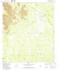
1979 Map of Vamori
USGS Topo · Published 1980About this map
The Papago Indian Reservation dominates this late-1970s topographic study, illustrating a landscape of high desert basins and isolated summits along the international border. The settlement of Vamori sits at the head of the Vamori Valley, where the ephemeral Vamori Wash drains through the arid plains. Life in this environment is clearly centered around water management, evidenced by the scattered corrals and infrastructure like Wamul Tank and Water Tank. To the west, the Alvarez Mountains rise sharply, featuring landmarks such as Rocky Point and Ram Boo Ranch. The southern edge of the map is defined by the United States Mexico border, underscoring the remote character of this desert region. Small clusters of habitation like Itak and several noted cemeteries provide critical touchpoints for genealogists and local historians researching the enduring communities of this borderland territory.
Find a feature on this map
19 named features on this map. Tap any name to fly to it.
Don’t see what you’re looking for? This feature index may not catch every label — zoom into the map to look around manually.
Map Details
Editions of this 1979 Vamori Map
This is the sole edition of this map. No revisions or reprints were ever made.
Other maps of this area

1941 · Vamori
USGS Topo · 1:62,500

1941 · Sells
USGS Topo · 1:62,500

1943 · Sells
USGS Topo · 1:62,500

1943 · Fresnal
USGS Topo · 1:125,000

1943 · Vamori
USGS Topo · 1:62,500

1954 · Sonoyta
USGS Topo · 1:250,000

1956 · Nogales
USGS Topo · 1:250,000

1958 · Nogales
USGS Topo · 1:250,000

1959 · Nogales
USGS Topo · 1:250,000

1963 · Gu Oidak
USGS Topo · 1:62,500