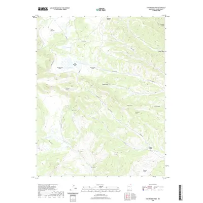
2020 Map of Van Bremmer Park
USGS Topo · Published 2020About this map
Van Bremmer Park serves as a central landmark in this high-altitude landscape of Colfax County, where the terrain is deeply etched by a network of drainages and canyons. The map documents a complex system of watercourses, including Van Bremmer Cr and McCrystal Cr, which flow through valleys named for early figures such as Harry Bremmer Canyon. A pair of high-country water bodies, Bremmer Lakes and Marys Lake, are situated near the northern park boundaries, providing vital water sources in this arid environment.
Find a feature on this map
32 named features on this map. Tap any name to fly to it.
Don’t see what you’re looking for? This feature index may not catch every label — zoom into the map to look around manually.
Map Details
Editions of this 2020 Van Bremmer Park Map
This is the sole edition of this map. No revisions or reprints were ever made.
Other maps of this area

1954 · Raton
USGS Topo · 1:250,000

1955 · Cimarron
USGS Topo · 1:62,500

1955 · Ute Park
USGS Topo · 1:62,500

1958 · Raton
USGS Topo · 1:250,000

1962 · Ash Mountain
USGS Topo · 1:62,500

1962 · Casa Grande
USGS Topo · 1:62,500

1981 · Raton
USGS Topo · 1:100,000

1982 · Wheeler Peak
USGS Topo · 1:100,000
1986 · Vermejo Park
USGS Topo · 1:24,000
1986 · Van Bremmer Park
USGS Topo · 1:24,000