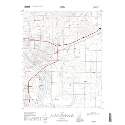
2020 Map of Van Buren
USGS Topo · Published 2020About this map
The Arkansas River serves as a major geographic boundary on this 2020 survey, separating Van Buren in Crawford County from the northern reaches of Fort Smith in Sebastian County. The urban center of Van Buren is anchored by the Crawford County Courthouse and its annex, surrounded by a dense network of residential streets and long-established local landmarks such as Fairview Cem and Crow Hill Cem. North of the city, the landscape transitions into smaller communities like Rena and Smeltzer, while the eastern portion of the quadrangle shows the rural character of Catcher and Kibler.
Find a feature on this map
130 named features on this map. Tap any name to fly to it.
Don’t see what you’re looking for? This feature index may not catch every label — zoom into the map to look around manually.
Map Details
Editions of this 2020 Van Buren Map
This is the sole edition of this map. No revisions or reprints were ever made.
Other maps of this area

1879 · Fort Smith
USGS Topo · 1:62,500

1887 · Van Buren
USGS Topo · 1:62,500

1890 · Fort Smith
USGS Topo · 1:125,000

1898 · Winslow #4
USGS Topo · 1:62,500

1898 · Winslow #3
USGS Topo · 1:62,500

1898 · Winslow
USGS Topo · 1:125,000

1901 · Winslow
USGS Topo · 1:125,000

1906 · Lavaca
USGS Topo · 1:62,500

1943 · Fort Smith
USGS Topo · 1:125,000

1946 · Fort Smith
USGS Topo · 1:250,000