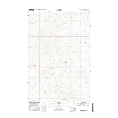
2017 Map of Van Dusen Spring
USGS Topo · Published 2017About this map
Van Dusen Spring serves as a vital water source in this high plains landscape of Garfield County, where the terrain is deeply etched by a network of drainage features. The map details a rugged topography defined by named erosional landmarks including Smiley Coulee, Wickstrom Coulee, and the lengthy Klein Coulee. These features illustrate the drainage patterns toward Sand Cr, which meanders through the western and southern sections of the survey area. Human presence is sparse, marked primarily by the utility of Guesanborn Reservoir and the lone transit of Guesanborn Rd. The land is organized by the Public Land Survey System, spanning townships such as t15n r36e, which highlights the remote, structured nature of this Montana ranching or grazing territory.
Find a feature on this map
15 named features on this map. Tap any name to fly to it.
Don’t see what you’re looking for? This feature index may not catch every label — zoom into the map to look around manually.
Map Details
Editions of this 2017 Van Dusen Spring Map
This is the sole edition of this map. No revisions or reprints were ever made.
Other maps of this area

1954 · Jordan
USGS Topo · 1:250,000

1954 · Forsyth
USGS Topo · 1:250,000

1956 · Jordan
USGS Topo · 1:250,000

1957 · Forsyth
USGS Topo · 1:250,000

1958 · Jordan
USGS Topo · 1:250,000

1958 · Forsyth
USGS Topo · 1:250,000

1964 · Jordan
USGS Topo · 1:250,000

1965 · Robertson School
USGS Topo · 1:24,000

1965 · Big Dry School
USGS Topo · 1:24,000

1965 · Edwards
USGS Topo · 1:24,000