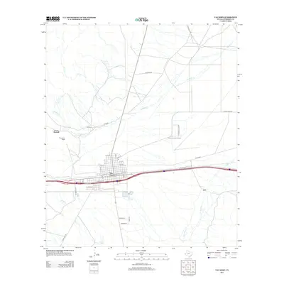
2012 Map of Van Horn
USGS Topo · Published 2012About this map
Van Horn serves as the central hub of this Trans-Pecos landscape, situated at a critical crossroads of western Texas travel. The town's grid is meticulously detailed, extending from W 11th St down to W Gramma St, showing the residential and commercial layout before the arid flats take over. Outside the town limits, the geography is defined by intermittent drainages like Hackberry Cr and Wild Horse Cr, which carve through the high desert toward Farmer Lake.
Find a feature on this map
36 named features on this map. Tap any name to fly to it.
Don’t see what you’re looking for? This feature index may not catch every label — zoom into the map to look around manually.
Map Details
Editions of this 2012 Van Horn Map
This is the sole edition of this map. No revisions or reprints were ever made.
Other maps of this area

1892 · Chispa
USGS Topo · 1:125,000

1895 · Chispa
USGS Topo · 1:125,000

1897 · Chispa
USGS Topo · 1:125,000

1906 · Van Horn
USGS Topo · 1:125,000

1954 · Van Horn
USGS Topo · 1:250,000

1958 · Van Horn
USGS Topo · 1:250,000

1959 · Marfa
USGS Topo · 1:250,000

1964 · Wild Horse
USGS Topo · 1:24,000
1964 · Hackett Peak
USGS Topo · 1:24,000

1964 · Watson Ranch
USGS Topo · 1:24,000