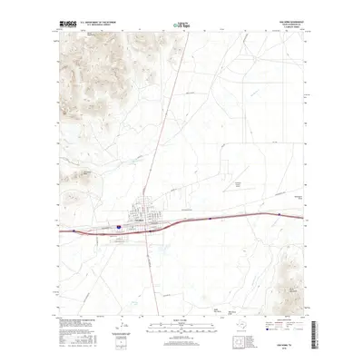
2016 Map of Van Horn
USGS Topo · Published 2016About this map
Van Horn serves as a critical Trans-Pecos crossroads, situated where the high desert floor meets the looming Beach Mountains and Wylie Mountains. This 2016 survey captures the town's grid and its role as a regional hub, defined by the convergence of major transit corridors and the Culberson County Airport. The landscape is marked by significant drainage patterns, including Wild Horse Draw and Eagle Flat Draw, which direct seasonal runoff from peaks like Threemile Peak.
Find a feature on this map
43 named features on this map. Tap any name to fly to it.
Don’t see what you’re looking for? This feature index may not catch every label — zoom into the map to look around manually.
Map Details
Editions of this 2016 Van Horn Map
This is the sole edition of this map. No revisions or reprints were ever made.
Other maps of this area

1892 · Chispa
USGS Topo · 1:125,000

1895 · Chispa
USGS Topo · 1:125,000

1897 · Chispa
USGS Topo · 1:125,000

1906 · Van Horn
USGS Topo · 1:125,000

1954 · Van Horn
USGS Topo · 1:250,000

1958 · Van Horn
USGS Topo · 1:250,000

1959 · Marfa
USGS Topo · 1:250,000

1964 · Wild Horse
USGS Topo · 1:24,000
1964 · Hackett Peak
USGS Topo · 1:24,000

1964 · Watson Ranch
USGS Topo · 1:24,000