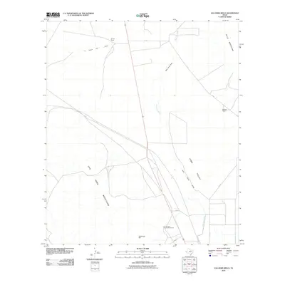
2010 Map of Van Horn Wells
USGS Topo · Published 2010About this map
Van Horn Wells (Historical Monument) marks a significant point of interest in this high desert landscape, situated between the Van Horn Mountains to the west and the Lobo Valley to the east. The terrain is defined by the convergence of prominent landforms and drainage systems, including the Wylie Mountains and the long expanse of Wild Horse Draw. The presence of Farmer Ranch and Waddell Ranch speaks to the long-standing ranching traditions in this part of Culberson County. Local drainage is characterized by features like Eagle Flat Draw and Wild Horse Creek, which channel seasonal water through the basins. Heliograph Hill stands as a distinct topographical marker, while local travel is facilitated by Lobo Rd and 101 Rd, connecting these remote rangelands.
Find a feature on this map
13 named features on this map. Tap any name to fly to it.
Don’t see what you’re looking for? This feature index may not catch every label — zoom into the map to look around manually.
Map Details
Editions of this 2010 Van Horn Wells Map
This is the sole edition of this map. No revisions or reprints were ever made.
Other maps of this area

1892 · Chispa
USGS Topo · 1:125,000

1895 · Chispa
USGS Topo · 1:125,000

1897 · Chispa
USGS Topo · 1:125,000

1906 · Van Horn
USGS Topo · 1:125,000

1954 · Van Horn
USGS Topo · 1:250,000

1958 · Van Horn
USGS Topo · 1:250,000

1959 · Marfa
USGS Topo · 1:250,000

1964 · Wild Horse
USGS Topo · 1:24,000
1964 · Hackett Peak
USGS Topo · 1:24,000

1964 · Van Horn
USGS Topo · 1:24,000