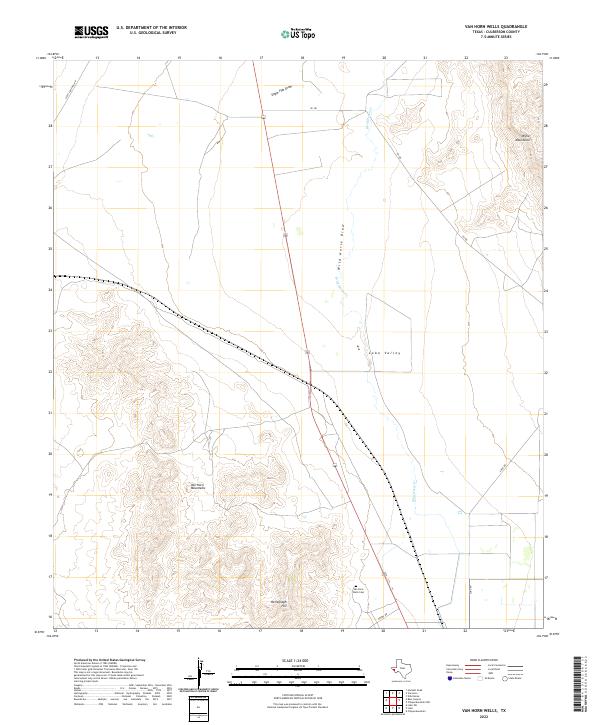
2022 Map of Van Horn Wells
USGS Topo · Published 2022About this map
Lobo Valley serves as the central corridor of this Culberson County landscape, flanked by the prominent elevations of the Van Horn Mountains to the southwest and the Wylie Mountains in the northeast corner. This arid basin is defined by drainage systems like Wild Horse Draw and Eagle Flat Draw, which channel intermittent water through the desert floor. The presence of the Van Horn Wells Cem provides a specific point of interest for genealogists and local historians, marking a human footprint in an otherwise sparsely populated ranching and mountain environment. Evidence of communication and surveillance history is found at Heliograph Hill, while a network of local thoroughfares including Scott Crossing Rd and Lobo Rd connect the isolated mountain passes and valley floor.
Find a feature on this map
12 named features on this map. Tap any name to fly to it.
Don’t see what you’re looking for? This feature index may not catch every label — zoom into the map to look around manually.
Map Details
Editions of this 2022 Van Horn Wells Map
This is the sole edition of this map. No revisions or reprints were ever made.
Other maps of this area

1892 · Chispa
USGS Topo · 1:125,000

1895 · Chispa
USGS Topo · 1:125,000

1897 · Chispa
USGS Topo · 1:125,000

1906 · Van Horn
USGS Topo · 1:125,000

1954 · Van Horn
USGS Topo · 1:250,000

1958 · Van Horn
USGS Topo · 1:250,000

1959 · Marfa
USGS Topo · 1:250,000

1964 · Wild Horse
USGS Topo · 1:24,000
1964 · Hackett Peak
USGS Topo · 1:24,000

1964 · Van Horn
USGS Topo · 1:24,000