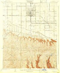
1926 Map of Van Nuys
USGS Topo · Published 1932About this map
The San Fernando Valley landscape centers on the burgeoning community of Van Nuys, shown during a transformative era of suburban planning and agricultural transition. Surveyed in the mid-1920s by E.P. Davis, the map reveals a grid of citrus groves and early residential blocks anchored by the Southern Pacific railroad line. Landmarks such as the Encino Country Club and Hollywood Country Club appear alongside the expansive Ex Mission San Fernando lands, illustrating the region's shift toward leisure and development. To the south, the Santa Monica Mountains rise sharply, punctuated by Beverly Glen and the newly established Mulholland Highway. The natural hydrology of the Los Angeles River and Tujunga Wash provides a stark contrast to the emerging infrastructure of Ventura Boulevard, capturing the Valley before it was fully integrated into the greater Los Angeles metropolis.
Find a feature on this map
34 named features on this map. Tap any name to fly to it.
Don’t see what you’re looking for? This feature index may not catch every label — zoom into the map to look around manually.
Map Details
Editions of this 1926 Van Nuys Map
4 editions found
Other maps of this area

1894 · Los Angeles
USGS Topo · 1:62,500

1896 · Santa Monica
USGS Topo · 1:62,500

1898 · Santa Monica
USGS Topo · 1:62,500

1900 · Los Angeles
USGS Topo · 1:62,500

1901 · Southern California Sheet No. 1
USGS Topo · 1:250,000

1902 · Santa Monica
USGS Topo · 1:62,500

1903 · Calabasas
USGS Topo · 1:62,500

1903 · Camulos
USGS Topo · 1:125,000

1904 · Southern California Sheet No. 1
USGS Topo · 1:250,000

1920 · Santa Monica
USGS Topo · 1:62,500