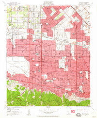
1953 Map of Van Nuys
USGS Topo · Published 1960About this map
Panorama City and Van Nuys form the urban core of this mid-century survey, capturing the San Fernando Valley during a period of massive residential expansion. The landscape is dominated by a dense grid of suburban development, yet the northern reaches still show significant industrial activity with numerous Gravel Pits and the sprawling San Fernando Valley Airport. The southern edge transitions abruptly into the Santa Monica Mountains, where Mulholland Drive winds along the ridgeline overlooking the burgeoning valley floor. Notable institutions such as the Sepulveda Veterans Administration Hospital and the Republic Studio highlight the region's diverse identity as a center for healthcare, military presence at the US Naval Reserve, and the entertainment industry. The drainage patterns of the Pacoima Wash and Tujunga Wash are clearly visible as they channel toward the Los Angeles River, which snakes through the southern communities of Sherman Oaks and Studio City.
Find a feature on this map
106 named features on this map. Tap any name to fly to it.
Don’t see what you’re looking for? This feature index may not catch every label — zoom into the map to look around manually.
Map Details
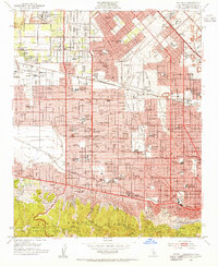
Editions of this 1953 Van Nuys Map
2 editions found
Other maps of this area

1894 · Los Angeles
USGS Topo · 1:62,500

1896 · Santa Monica
USGS Topo · 1:62,500

1898 · Santa Monica
USGS Topo · 1:62,500

1900 · Los Angeles
USGS Topo · 1:62,500

1900 · Fernando
USGS Topo · 1:62,500

1901 · Southern California Sheet No. 1
USGS Topo · 1:250,000

1902 · Santa Monica
USGS Topo · 1:62,500

1903 · Calabasas
USGS Topo · 1:62,500

1903 · Camulos
USGS Topo · 1:125,000

1903 · Santa Susana
USGS Topo · 1:62,500
Featured Places
- Los Angeles, CA
- Los Angeles County, CA
- United States
- California
- Van Nuys Neighborhood Council District, Los Angeles