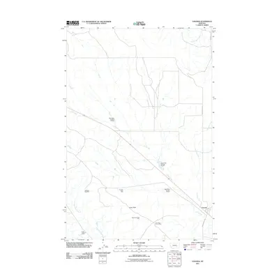
2011 Map of Vananda
USGS Topo · Published 2011About this map
Vananda and the surrounding high plains of Rosebud County are defined by a complex network of resource extraction and water management. The landscape is dotted with mining operations, particularly around the prominent Cedar Ridge landform. These include the NW Cedar Ridge Mine, NE Cedar Ridge Mine, West Cedar Ridge Mine, and the Cedar Ridge Junction Mine, along with the Roach Coulee 8, 9 Mine further south. These labels suggest a region deeply tied to the industrial geography of Montana's coal or mineral sectors.
Find a feature on this map
15 named features on this map. Tap any name to fly to it.
Don’t see what you’re looking for? This feature index may not catch every label — zoom into the map to look around manually.
Map Details
Editions of this 2011 Vananda Map
This is the sole edition of this map. No revisions or reprints were ever made.
Other maps of this area

1954 · Forsyth
USGS Topo · 1:250,000

1957 · Forsyth
USGS Topo · 1:250,000

1958 · Forsyth
USGS Topo · 1:250,000

1960 · Hysham
USGS Topo · 1:24,000

1960 · Vananda
USGS Topo · 1:24,000

1960 · Ahles
USGS Topo · 1:24,000

1960 · Sanders
USGS Topo · 1:24,000

1960 · Thebes
USGS Topo · 1:24,000

1960 · Zempel Lake
USGS Topo · 1:24,000

1968 · Donleys Reservoir
USGS Topo · 1:24,000