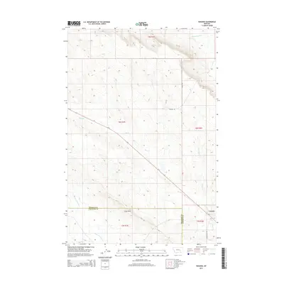
2014 Map of Vananda
USGS Topo · Published 2014About this map
Vananda sits along the Us-12 corridor in this eastern Montana landscape, marking a central point of settlement within the Treasure and Rosebud County borderlands. The geography is defined by high drainage divides and seasonal watercourses, most notably the evocatively named Starved to Death Creek which flows through the southwestern corner. North of Cedar Ridge, the terrain rises toward the slopes of Big Porcupine Creek, while Horse Creek and Anderson Creek carve shallow valleys through the central sections of the survey. Local transportation is anchored by a grid of rural routes including Scott Road, McCaskie Road, and Mission Valley Road, which facilitate access across the vast sections of t8n r37e and surrounding townships. This map provides a clear record of the intersection between early twentieth-century roadway development and the natural drainages that have long dictated the movement of livestock and people in this semi-arid region.
Find a feature on this map
17 named features on this map. Tap any name to fly to it.
Don’t see what you’re looking for? This feature index may not catch every label — zoom into the map to look around manually.
Map Details
Editions of this 2014 Vananda Map
This is the sole edition of this map. No revisions or reprints were ever made.
Other maps of this area

1954 · Forsyth
USGS Topo · 1:250,000

1957 · Forsyth
USGS Topo · 1:250,000

1958 · Forsyth
USGS Topo · 1:250,000

1960 · Hysham
USGS Topo · 1:24,000

1960 · Vananda
USGS Topo · 1:24,000

1960 · Ahles
USGS Topo · 1:24,000

1960 · Sanders
USGS Topo · 1:24,000

1960 · Thebes
USGS Topo · 1:24,000

1960 · Zempel Lake
USGS Topo · 1:24,000

1968 · Donleys Reservoir
USGS Topo · 1:24,000