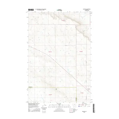
2017 Map of Vananda
USGS Topo · Published 2017About this map
Vananda sits at the edge of this vast high-plains landscape, situated where the Treasure and Rosebud county lines meet. The drainage patterns of the region are defined by several prominent waterways, including Big Porcupine Cr in the north and the uniquely named Starved to Death Cr to the south. Centrally, Horse Cr cuts a diagonal path through the terrain, accompanied by the primary rail and road corridor. This area is characterized by significant topographic shifts, most notably at Cedar Ridge, which rises above the surrounding plains. The grid of local roads, such as Scott Rd and McCaskie Rd, illustrates the rural distribution of land and access across the big sky country of Montana during this period.
Find a feature on this map
17 named features on this map. Tap any name to fly to it.
Don’t see what you’re looking for? This feature index may not catch every label — zoom into the map to look around manually.
Map Details
Editions of this 2017 Vananda Map
This is the sole edition of this map. No revisions or reprints were ever made.
Other maps of this area

1954 · Forsyth
USGS Topo · 1:250,000

1957 · Forsyth
USGS Topo · 1:250,000

1958 · Forsyth
USGS Topo · 1:250,000

1960 · Hysham
USGS Topo · 1:24,000

1960 · Vananda
USGS Topo · 1:24,000

1960 · Ahles
USGS Topo · 1:24,000

1960 · Sanders
USGS Topo · 1:24,000

1960 · Thebes
USGS Topo · 1:24,000

1960 · Zempel Lake
USGS Topo · 1:24,000

1968 · Donleys Reservoir
USGS Topo · 1:24,000