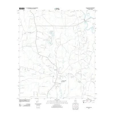
2012 Map of Vancleave
USGS Topo · Published 2012About this map
The Pascagoula River corridor dominates the eastern edge of this Jackson County landscape, characterized by an intricate network of oxbows and backwaters including Graham Lake, Cat Lake, and Polly Lake. Inland from the river, the unincorporated community of Vancleave serves as a central hub, surrounded by smaller settlements like Evergreen and water-access points such as McCall Landing and Dees Landing. The geography is defined by the convergence of numerous drainage systems, with Bluff Cr and Little Bluff Cr winding through the southern reaches, while Waters Cr and Little Cr feed into the central basin near Spring Lake.
Find a feature on this map
145 named features on this map. Tap any name to fly to it.
Don’t see what you’re looking for? This feature index may not catch every label — zoom into the map to look around manually.
Map Details
Editions of this 2012 Vancleave Map
This is the sole edition of this map. No revisions or reprints were ever made.
Other maps of this area

1941 · Vancleave
USGS Topo · 1:62,500

1943 · Pascagoula
USGS Topo · 1:62,500

1943 · Vancleave
USGS Topo · 1:62,500

1944 · Vancleave
USGS Topo · 1:62,500

1953 · Mobile
USGS Topo · 1:250,000

1954 · Vestry
USGS Topo · 1:62,500

1954 · Ocean Springs
USGS Topo · 1:24,000

1954 · Biloxi
USGS Topo · 1:62,500

1955 · Pascagoula
USGS Topo · 1:62,500

1957 · Mobile
USGS Topo · 1:250,000