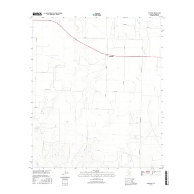
2016 Map of Vancourt
USGS Topo · Published 2016About this map
Vancourt anchors this section of Tom Green County, situated along the path of U.S. Route 87. The landscape is defined by the drainage patterns of Lipan Cr and Hog Marsh Cr, which wind through a grid of rural ranch roads and family-named thoroughfares. The road network reflects a history of local land ownership and movement, with labels like Untermeyer Rd, Holik Rd, and Brenek Rd indicating the ancestral footprints of the area's residents.
Find a feature on this map
22 named features on this map. Tap any name to fly to it.
Don’t see what you’re looking for? This feature index may not catch every label — zoom into the map to look around manually.
Map Details
Editions of this 2016 Vancourt Map
This is the sole edition of this map. No revisions or reprints were ever made.
Other maps of this area

1892 · San Angelo
USGS Topo · 1:125,000

1928 · Wall
USGS Topo · 1:62,500

1954 · San Angelo
USGS Topo · 1:250,000

1957 · Eola
USGS Topo · 1:62,500

1957 · Wall
USGS Topo · 1:62,500

1958 · San Angelo
USGS Topo · 1:250,000

1965 · San Angelo
USGS Topo · 1:250,000
1970 · Burr Oak Creek
USGS Topo · 1:24,000
1970 · Kickapoo Spring
USGS Topo · 1:24,000
1972 · Susan Peak
USGS Topo · 1:24,000