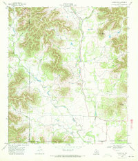
1969 Map of Vanderpool
USGS Topo · Published 1972About this map
The Sabinal River valley defines the character of this section of the Texas Hill Country, where the watercourse and its western fork, the West Sabinal River, converge south of Vanderpool. The landscape is dominated by a complex network of draws and hollows, such as Jernigan Hollow and Starvation Hollow, that carve into the limestone uplands. These features reveal a rural economy dependent on topography, with small-scale aviation indicated by a remote Landing Strip and local industry marked by a Gravel Pit. Genealogists and local historians can locate the Jones Cem near the southern boundary where the terrain begins to level. High points like Taylor Mountain and Wernette Mountain provide significant vertical relief, illustrating the drainage patterns that feed the river system and shape the settlement roads through the canyons.
Find a feature on this map
33 named features on this map. Tap any name to fly to it.
Don’t see what you’re looking for? This feature index may not catch every label — zoom into the map to look around manually.
Map Details
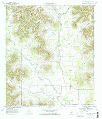
Editions of this 1969 Vanderpool Map
2 editions found
Other maps of this area

1954 · San Antonio
USGS Topo · 1:250,000

1956 · Tarpley
USGS Topo · 1:62,500

1956 · Tuff
USGS Topo · 1:62,500

1956 · Utopia
USGS Topo · 1:62,500

1957 · San Antonio
USGS Topo · 1:250,000

1960 · Magers Crossing
USGS Topo · 1:24,000

1964 · Circle Bluff
USGS Topo · 1:24,000

1964 · Sabinal Canyon
USGS Topo · 1:24,000
1964 · Love Creek
USGS Topo · 1:24,000
1964 · Seco Pass
USGS Topo · 1:24,000