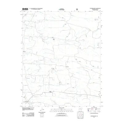
2011 Map of Vandervoort
USGS Topo · Published 2011About this map
Vandervoort anchors the southwestern corner of this Polk County landscape, serving as a primary point of settlement along a network of rural roads that stretch toward the surrounding hills. The area is defined by its small community centers and scattered local burial grounds, including the Whole Council of God Cemetery near McCauley and the Lone Valley Cemetery further north. These sites, along with Bethel Chapel, suggest a geography organized around longtime family homesteads and local congregations.
Find a feature on this map
57 named features on this map. Tap any name to fly to it.
Don’t see what you’re looking for? This feature index may not catch every label — zoom into the map to look around manually.
Map Details
Editions of this 2011 Vandervoort Map
This is the sole edition of this map. No revisions or reprints were ever made.
Other maps of this area

1890 · Poteau Mountain
USGS Topo · 1:125,000

1899 · Poteau Mountain
USGS Topo · 1:125,000

1913 · De Queen
USGS Topo · 1:125,000

1950 · Mcalester
USGS Topo · 1:250,000

1958 · Mena
USGS Topo · 1:62,500

1958 · Potter
USGS Topo · 1:62,500

1958 · Zafra
USGS Topo · 1:24,000

1958 · Mena
USGS Topo · 1:24,000
1958 · Potter
USGS Topo · 1:24,000

1959 · Umpire
USGS Topo · 1:62,500