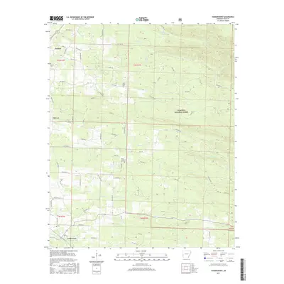
2017 Map of Vandervoort
USGS Topo · Published 2017About this map
Hatfield and Vandervoort anchor this section of Polk County, where the topography transitions from the valley floor into the wooded heights of the Ouachita National Forest. The map captures a rural landscape defined by an intricate network of waterways like Sixmile Cr and Buffalo Cr, which carve through the terrain between small settlements and timbered tracts. For those tracing family history, the map provides precise locations for numerous small burial grounds, including Sixmile Cem, Lone Valley Cem, and the Whole Council of God Cem. The settlement of Old Cove sits along the western edge, illustrating the dispersed residential pattern of this upland region. The road network, including the historic routes of Polk Road 31 and Polk Road 36, follows the natural contours of the land, connecting isolated farmsteads to the larger community centers.
Find a feature on this map
66 named features on this map. Tap any name to fly to it.
Don’t see what you’re looking for? This feature index may not catch every label — zoom into the map to look around manually.
Map Details
Editions of this 2017 Vandervoort Map
This is the sole edition of this map. No revisions or reprints were ever made.
Other maps of this area

1890 · Poteau Mountain
USGS Topo · 1:125,000

1899 · Poteau Mountain
USGS Topo · 1:125,000

1913 · De Queen
USGS Topo · 1:125,000

1950 · Mcalester
USGS Topo · 1:250,000

1958 · Mena
USGS Topo · 1:62,500

1958 · Potter
USGS Topo · 1:62,500

1958 · Zafra
USGS Topo · 1:24,000

1958 · Mena
USGS Topo · 1:24,000
1958 · Potter
USGS Topo · 1:24,000

1959 · Umpire
USGS Topo · 1:62,500