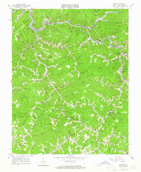
1963 Map of Vansant
USGS Topo · Published 1965About this map
Levisa Fork cuts a winding path through this corner of the Appalachian Plateau in the early 1960s, serving as the primary corridor for both the Norfolk and Western railway and concentrated settlements like Vansant, Deel, and Oakwood. The landscape is defined by its ridge-and-hollow geography, where family names are etched into the terrain through features like Looney Ridge, Turkey Pen Ridge, and Keen Mtn.
Find a feature on this map
104 named features on this map. Tap any name to fly to it.
Don’t see what you’re looking for? This feature index may not catch every label — zoom into the map to look around manually.
Map Details
Editions of this 1963 Vansant Map
2 editions found
Other maps of this area

1886 · Grundy
USGS Topo · 1:125,000

1890 · Grundy
USGS Topo · 1:125,000

1891 · Tazewell
USGS Topo · 1:125,000

1892 · Grundy
USGS Topo · 1:125,000

1895 · Tazewell
USGS Topo · 1:125,000

1897 · Tazewell
USGS Topo · 1:125,000

1910 · Iaeger
USGS Topo · 1:48,000

1912 · Iaeger
USGS Topo · 1:62,500

1914 · Bucu
USGS Topo · 1:48,000

1914 · Iaeger
USGS Topo · 1:48,000