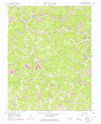
1963 Map of Vansant
USGS Topo · Published 1978About this map
Vansant serves as a focal point along the Levisa Fork in this mid-century Buchanan County survey, where the Norfolk and Western railway snakes through the narrow valleys to service the region's extraction industry. The landscape is defined by its deep drainage networks, including Prater Creek and Fletcher Creek, which separate prominent landforms like Boyd Ridge and Winding Ridge. The map details a dense social geography of the 1960s, documenting numerous family-named landmarks such as Ratcliff Chapel and Breeding Cemetery. Distinctive commercial and community sites, including the Vansant Theater and the Indian Gap Post Office, are mapped alongside the extensive Strip Mine operations that characterize the industrial footprint of the era. This edition also includes later revisions that track the growth of smaller settlements like Oakwood and Mavisdale along the eastern edge of the quadrangle.
Find a feature on this map
118 named features on this map. Tap any name to fly to it.
Don’t see what you’re looking for? This feature index may not catch every label — zoom into the map to look around manually.
Map Details
Editions of this 1963 Vansant Map
2 editions found
Other maps of this area

1886 · Grundy
USGS Topo · 1:125,000

1890 · Grundy
USGS Topo · 1:125,000

1891 · Tazewell
USGS Topo · 1:125,000

1892 · Grundy
USGS Topo · 1:125,000

1895 · Tazewell
USGS Topo · 1:125,000

1897 · Tazewell
USGS Topo · 1:125,000

1910 · Iaeger
USGS Topo · 1:48,000

1912 · Iaeger
USGS Topo · 1:62,500

1914 · Bucu
USGS Topo · 1:48,000

1914 · Iaeger
USGS Topo · 1:48,000