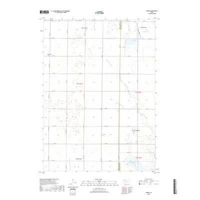
2018 Map of Varina
USGS Topo · Published 2018About this map
The town of Varina sits near the eastern boundary of this survey, serving as a focal point for the surrounding agricultural landscape on the border of Buena Vista and Pocahontas Counties. The terrain is defined by a sophisticated water management system designed to drain the fertile prairie, characterized by the prominent Drainage Ditch Number 188, Drainage Ditch 67, and Drainage Ditch Number 20. These man-made channels intersect with natural features like Little Cedar Cr and the marshy margins of Sunken Island Lake. Local history is anchored by the Varina Cem south of the village and Saint Johns Lutheran Cem to the northwest. The grid of section lines and roads such as Co Hwy N14 and Co Hwy M54 reflects the orderly township and range system that organized this part of Iowa for over a century.
Find a feature on this map
36 named features on this map. Tap any name to fly to it.
Don’t see what you’re looking for? This feature index may not catch every label — zoom into the map to look around manually.
Map Details
Editions of this 2018 Varina Map
This is the sole edition of this map. No revisions or reprints were ever made.
Other maps of this area

1954 · Fort Dodge
USGS Topo · 1:250,000

1957 · Fort Dodge
USGS Topo · 1:250,000

1958 · Fort Dodge
USGS Topo · 1:250,000

1971 · Sioux Rapids SE
USGS Topo · 1:24,000

1971 · Albert City
USGS Topo · 1:24,000

1971 · Laurens
USGS Topo · 1:24,000

1979 · Varina
USGS Topo · 1:24,000

1979 · Fonda
USGS Topo · 1:24,000

1979 · Newell West
USGS Topo · 1:24,000

1979 · Storm Lake NE
USGS Topo · 1:24,000