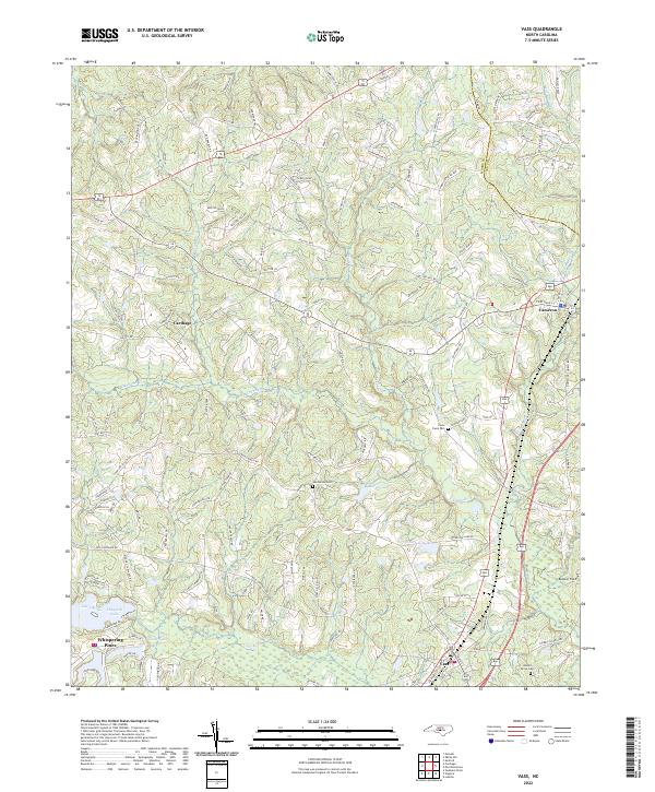
2022 Map of Vass
USGS Topo · Published 2022About this map
The town of Vass serves as a southern anchor for this portion of the Sandhills, where modern infrastructure meets the rural legacies of central North Carolina. The landscape is defined by the winding course of Crane Creek and Little River, which feed into several prominent water bodies including Thagards Lake and Morses Lake. Further north, the established settlements of Carthage and Cameron are linked by a network of rural routes such as State Rd 1816. For those researching local heritage, the map identifies family and community landmarks like the Henderson Cemetery, Crane Creek Cemetery, and Johnson Grove Cemetery. The terrain is characterized by distinctive elevations like Red Fox Ridge and Red Hill Road, while the inclusion of the Moore Co Lee Co boundary illustrates the regional administrative divisions during this era of 21st-century development.
Find a feature on this map
128 named features on this map. Tap any name to fly to it.
Don’t see what you’re looking for? This feature index may not catch every label — zoom into the map to look around manually.
Map Details
Editions of this 2022 Vass Map
This is the sole edition of this map. No revisions or reprints were ever made.
Other maps of this area

1948 · Southern Pines
USGS Topo · 1:62,500

1948 · Clifdale
USGS Topo · 1:62,500

1950 · Lobelia
USGS Topo · 1:24,000

1950 · Niagara
USGS Topo · 1:24,000

1950 · Southern Pines
USGS Topo · 1:24,000

1951 · Clifdale
USGS Topo · 1:62,500

1953 · Raleigh
USGS Topo · 1:250,000

1954 · Raleigh
USGS Topo · 1:250,000

1957 · Murchisontown
USGS Topo · 1:24,000

1957 · Southern Pines
USGS Topo · 1:62,500