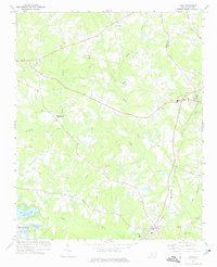
1974 Map of Vass
USGS Topo · Published 1976About this map
The Seaboard Coast Line corridor anchors this portion of Moore County, connecting the settlements of Cameron and Vass. The landscape is defined by the winding course of Crane Creek and Little Crane Creek, which carve through a region transitioning from rural agricultural tracts to established community centers. An Old Railroad Grade north of Cameron offers a literal trace of former transit patterns, while the development of Whispering Pines in the southwest, centered around Thagards Lake and Pine Lake, illustrates the era's evolving residential and recreational footprint.
Find a feature on this map
34 named features on this map. Tap any name to fly to it.
Don’t see what you’re looking for? This feature index may not catch every label — zoom into the map to look around manually.
Map Details
Editions of this 1974 Vass Map
This is the sole edition of this map. No revisions or reprints were ever made.
Other maps of this area

1948 · Southern Pines
USGS Topo · 1:62,500

1948 · Clifdale
USGS Topo · 1:62,500

1950 · Lobelia
USGS Topo · 1:24,000

1950 · Niagara
USGS Topo · 1:24,000

1950 · Southern Pines
USGS Topo · 1:24,000

1951 · Clifdale
USGS Topo · 1:62,500

1953 · Raleigh
USGS Topo · 1:250,000

1954 · Raleigh
USGS Topo · 1:250,000

1957 · Murchisontown
USGS Topo · 1:24,000

1957 · Southern Pines
USGS Topo · 1:62,500