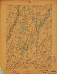
1893 Map of Vassalboro
USGS Topo · Published 1898About this map
Kennebec River corridor life is recorded here during the late nineteenth century, showing a landscape defined by its glacial lakes and the early industrial influence of the Maine Central RR. The topography reveals a series of north-south drumlins and ridges that separate the Kennebec from the upper reaches of the Sheepscot River. Several smaller milling and agricultural centers like Seaward Mills and Weeks Mills appear alongside the larger village at North Vassalboro, which sits at the head of the Outlet Stream. The area's hydrology is complex, dominated by the massive China Lake and a string of smaller bodies including Togus Pond and Threemile Pond. This survey offers a precise view of the rural road network and township boundaries such as Windsor and Vassalboro before the twentieth-century expansion of local infrastructure.
Find a feature on this map
57 named features on this map. Tap any name to fly to it.
Don’t see what you’re looking for? This feature index may not catch every label — zoom into the map to look around manually.
Map Details
Editions of this 1893 Vassalboro Map
5 editions found
Other maps of this area

1892 · Gardiner
USGS Topo · 1:62,500

1892 · Waterville
USGS Topo · 1:62,500

1892 · Augusta
USGS Topo · 1:62,500

1893 · Vassalboro
USGS Topo · 1:62,500

1893 · Wiscasset
USGS Topo · 1:62,500

1894 · Norridgewock
USGS Topo · 1:62,500

1898 · Norridgewock
USGS Topo · 1:62,500

1898 · Vassalboro
USGS Topo · 1:62,500

1913 · Waldoboro
USGS Topo · 1:48,000

1915 · Waldoboro
USGS Topo · 1:62,500