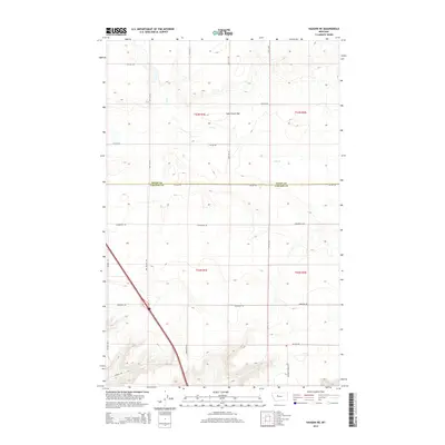
2014 Map of Vaughn NE
USGS Topo · Published 2014About this map
The boundary between Teton Co and Cascade Co bisects this stretch of the northern Montana plains, a landscape defined by expansive benchlands and seasonal drainages. Much of the northern half of the sheet is occupied by the broad, low-lying Lake Creek Flat, where the intermittent waters of Lake Cr wind through the sectioned terrain. The map reveals a strict rectilinear grid of rural roads named for early ranching families and local landmarks, including Neuman Rd, Somerfeld Rd, and Old Gettle Rd. These routes provide essential access to the remote township corners of T22N and T23N. Evidence of the area's educational history is preserved in the naming of Neuman School Rd in the southern portion of the quadrangle, hinting at the community hubs that once anchored these large-scale agricultural operations.
Find a feature on this map
24 named features on this map. Tap any name to fly to it.
Don’t see what you’re looking for? This feature index may not catch every label — zoom into the map to look around manually.
Map Details
Editions of this 2014 Vaughn NE Map
This is the sole edition of this map. No revisions or reprints were ever made.
Other maps of this area

1886 · Great Falls
USGS Topo · 1:250,000

1949 · Timber Coulee
USGS Topo · 1:62,500

1949 · Great Falls
USGS Topo · 1:62,500

1949 · Vaughn
USGS Topo · 1:62,500

1950 · Timber Coulee
USGS Topo · 1:62,500

1950 · Dutton
USGS Topo · 1:62,500

1951 · Great Falls
USGS Topo · 1:62,500

1952 · Vaughn
USGS Topo · 1:62,500

1954 · Great Falls
USGS Topo · 1:250,000

1957 · Great Falls
USGS Topo · 1:250,000