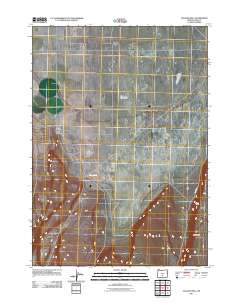
2011 Map of Vaughn Well
USGS Topo · Published 2011About this map
Christmas Lake Valley defines the expansive landscape of this eastern Lake County region during the early twenty-first century. The area is characterized by a sparse network of roads and essential desert water sources, most notably the namesake Vaughn Well. To the southeast, the terrain rises significantly at the Burma Rim, a prominent escarpment that runs parallel to Burma Rd. This USGS survey illustrates the isolation of the Oregon high desert, where surveying lines and minimal infrastructure indicate a landscape primarily dedicated to ranching or open range. The layout of the roads follows a strict grid system typical of the valley, while the natural topography of the rim provides a stark contrast to the level basin floor.
Find a feature on this map
4 named features on this map. Tap any name to fly to it.
Don’t see what you’re looking for? This feature index may not catch every label — zoom into the map to look around manually.
Map Details
Editions of this 2011 Vaughn Well Map
This is the sole edition of this map. No revisions or reprints were ever made.
Other maps of this area

1955 · Crescent
USGS Topo · 1:250,000

1957 · Crescent
USGS Topo · 1:250,000

1958 · Crescent
USGS Topo · 1:250,000

1970 · Crescent
USGS Topo · 1:250,000

1981 · Fossil Lake
USGS Topo · 1:24,000

1981 · Sand Rock
USGS Topo · 1:24,000

1982 · Christmas Lake
USGS Topo · 1:24,000
1985 · Fire Lake
USGS Topo · 1:24,000

1986 · St. Patrick Mtn.
USGS Topo · 1:24,000
1986 · Fandango Canyon
USGS Topo · 1:24,000