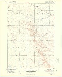
1950 Map of Vayland
USGS Topo · Published 1950About this map
Vayland serves as the focal point for this mid-century look at the prairie landscape of Hand County, where the Chicago and North Western railroad cuts across the northern landscape. The map reveals a highly organized rural society defined by its township boundaries and one-room schoolhouses, including Vitters Sch, Springdale Sch, and Kanaly Sch. These schools, spaced several miles apart, reflect the distribution of farmstead families across St Lawrence and Hulbert during this era.
Find a feature on this map
15 named features on this map. Tap any name to fly to it.
Don’t see what you’re looking for? This feature index may not catch every label — zoom into the map to look around manually.
Map Details
Editions of this 1950 Vayland Map
2 editions found
Other maps of this area

1899 · Redfield
USGS Topo · 1:125,000

1949 · Vayland SE
USGS Topo · 1:24,000

1949 · Vayland SW
USGS Topo · 1:24,000

1950 · Vayland
USGS Topo · 1:24,000

1950 · Wessington
USGS Topo · 1:24,000

1950 · Vayland NW
USGS Topo · 1:24,000

1951 · Vayland SW
USGS Topo · 1:24,000

1951 · Wessington SW
USGS Topo · 1:24,000

1951 · Vayland SE
USGS Topo · 1:24,000

1953 · Huron
USGS Topo · 1:250,000