
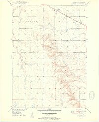
1950 Map of Vayland
USGS Topo · Published 1950About this map
Vayland serves as a small railroad-anchored settlement in this mid-century survey of Hand County. The community is situated along the Chicago And North Western railroad, which cuts a diagonal path across the northern prairies. The landscape is characterized by a sparse but organized network of rural education, evidenced by the distribution of several family-named schoolhouses such as Vitters Sch, Ford Sch, and Rombough Sch.
Find a feature on this map
15 named features on this map. Tap any name to fly to it.
Don’t see what you’re looking for? This feature index may not catch every label — zoom into the map to look around manually.
Map Details
Editions of this 1950 Vayland Map
2 editions found
Other maps of this area

1899 · Redfield
USGS Topo · 1:125,000

1949 · Vayland SE
USGS Topo · 1:24,000

1949 · Vayland SW
USGS Topo · 1:24,000

1950 · Wessington
USGS Topo · 1:24,000

1950 · Vayland NW
USGS Topo · 1:24,000

1951 · Vayland SW
USGS Topo · 1:24,000

1951 · Wessington SW
USGS Topo · 1:24,000

1951 · Vayland SE
USGS Topo · 1:24,000

1953 · Huron
USGS Topo · 1:250,000

1954 · Huron
USGS Topo · 1:250,000