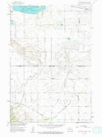
1958 Map of Veblen NE
USGS Topo · Published 1959About this map
Lake Tewaukon and the surrounding Tewaukon National Wildlife Refuge anchor the northern landscape of this prairie region, which straddles the North Dakota-South Dakota border. This late 1950s survey documents a sparse rural environment defined by the transition from the Sisseton Indian Reservation to organized counties. Cultural markers such as Palestina Ch and Mountain Head Ch reflect the community hubs of the era, while the inclusion of School No 1 (Abandoned) and School No 3 (Abandoned) signals a shifting demographic as smaller local districts were being consolidated. The Minneapolis St. Paul and Sault Ste Marie line cuts through the southern portion, providing a critical rail link across the drainages of La Belle Creek and Shortfoot Creek.
Find a feature on this map
20 named features on this map. Tap any name to fly to it.
Don’t see what you’re looking for? This feature index may not catch every label — zoom into the map to look around manually.
Map Details
Editions of this 1958 Veblen NE Map
3 editions found
Other maps of this area

1907 · Wyndmere
USGS Topo · 1:125,000

1953 · Milbank
USGS Topo · 1:250,000

1953 · Fargo
USGS Topo · 1:250,000

1956 · Fargo
USGS Topo · 1:250,000

1958 · Milbank
USGS Topo · 1:250,000

1958 · Hillhead
USGS Topo · 1:24,000

1958 · Veblen
USGS Topo · 1:24,000

1958 · Marlow
USGS Topo · 1:24,000

1958 · Veblen NE
USGS Topo · 1:24,000

1958 · Geneseo
USGS Topo · 1:24,000