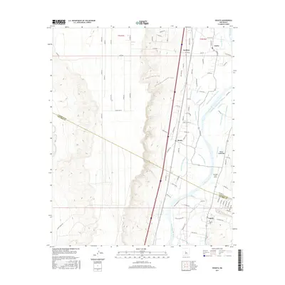
2017 Map of Veguita
USGS Topo · Published 2017About this map
The Rio Grande corridor south of Belen unfolds in this 2017 study, revealing a complex hydraulic landscape of irrigation ditches and drains that sustain the valley floor. Small settlements like Pueblitos, Jarales, and Bosque are linked by a dense network of local roads such as Pueblocitos Rd and Jarales Rd, while the Veguita Cem and Veguita town mark the southern reaches of the sheet near the Valencia and Socorro County line. The agrarian character of the region is punctuated by the Skywagon Farm Airport and a sophisticated water management system including the Old Jarales Ditch, Sabinal Ditch, and Casa Colorada Canal. These features highlight the ongoing importance of the river’s floodplain for local habitation and agriculture, even as modern infrastructure like Interstate 25 bisects the more arid western bluffs.
Find a feature on this map
93 named features on this map. Tap any name to fly to it.
Don’t see what you’re looking for? This feature index may not catch every label — zoom into the map to look around manually.
Map Details
Editions of this 2017 Veguita Map
This is the sole edition of this map. No revisions or reprints were ever made.
Other maps of this area

1916 · La Joya
USGS Topo · 1:125,000

1952 · La Joya NW
USGS Topo · 1:24,000

1952 · Belen SW
USGS Topo · 1:24,000

1952 · Black Butte
USGS Topo · 1:24,000

1952 · Belen
USGS Topo · 1:24,000

1952 · Turn
USGS Topo · 1:24,000

1952 · Veguita
USGS Topo · 1:24,000

1952 · Belen NW
USGS Topo · 1:24,000

1952 · Tome
USGS Topo · 1:24,000

1952 · Abeytas
USGS Topo · 1:24,000