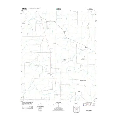
2011 Map of Velvet Ridge
USGS Topo · Published 2011About this map
Velvet Ridge serves as a central point in this rural Arkansas landscape, where small crossroads communities and family burying grounds are tucked between winding creek beds. To the north, the settlement of Denmark is situated near Fourmile Creek, while Heffington and the curiously named Twentythree anchor the eastern and southern reaches of the quadrangle. The terrain is defined by a series of prominent rises including Buzzard Roost Mountain and Throckmorton Hill, which overlook a network of waterways like Glaise Creek and Stevens Creek. Genealogists will find significant value in the distribution of local cemeteries, such as Bethlehem Cemetery and Smith Cemetery, which are connected by a web of rural routes like Chicken House Rd and Dripping Springs Rd. This survey documents a quiet interior region of Arkansas where land use is dictated by the ridges and creek valleys.
Find a feature on this map
95 named features on this map. Tap any name to fly to it.
Don’t see what you’re looking for? This feature index may not catch every label — zoom into the map to look around manually.
Map Details
Editions of this 2011 Velvet Ridge Map
This is the sole edition of this map. No revisions or reprints were ever made.
Other maps of this area

1890 · Batesville
USGS Topo · 1:125,000

1891 · Batesville
USGS Topo · 1:125,000

1935 · Newport
USGS Topo · 1:62,500

1935 · Augusta
USGS Topo · 1:62,500

1935 · Bald Knob
USGS Topo · 1:62,500

1953 · Memphis
USGS Topo · 1:250,000

1956 · Memphis
USGS Topo · 1:250,000

1957 · Augusta
USGS Topo · 1:62,500
1962 · Olyphant
USGS Topo · 1:24,000
1962 · Newport
USGS Topo · 1:62,500