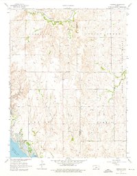
1957 Map of Venango
USGS Topo · Published 1976About this map
The Union Pacific railroad corridor defines the northern landscape of this region, passing through the small settlements of Terra Cotta and Arcola. This 1957 survey captures the area following the mid-century engineering of the Smoky Hill River valley, anchored by the Kanopolis Dam and the expansive Kanopolis Lake. Near the lake's edge, the town of Venango and the Kanopolis Landing Field serve as local landmarks. The terrain transitions from the alluvial bottomlands to the prominent Smoky Hill Range and high points like Buzzard Roost. For genealogists and local historians, the map identifies specific burial sites including the Terra Cotta Cem and Summit Cem, preserving the location of early rural communities near Spring Creek and Wiley Creek.
Find a feature on this map
20 named features on this map. Tap any name to fly to it.
Don’t see what you’re looking for? This feature index may not catch every label — zoom into the map to look around manually.
Map Details
Editions of this 1957 Venango Map
4 editions found
Other maps of this area

1892 · Salina
USGS Topo · 1:125,000

1894 · Ellsworth
USGS Topo · 1:125,000

1942 · Salina
USGS Topo · 1:125,000

1955 · Brookville
USGS Topo · 1:24,000

1955 · Falun
USGS Topo · 1:24,000

1955 · Great Bend
USGS Topo · 1:250,000

1955 · Hutchinson
USGS Topo · 1:250,000

1957 · Great Bend
USGS Topo · 1:250,000

1957 · Brookville SW
USGS Topo · 1:24,000

1957 · Westfall SE
USGS Topo · 1:24,000